Every node on the mesh is a sensor with a GPS position and a timestamp. Cats carry them at street level, owned pigeons on rooftops, the drone in a vertical column. Below is what falls out of that, who in the city uses it, and how it's delivered.
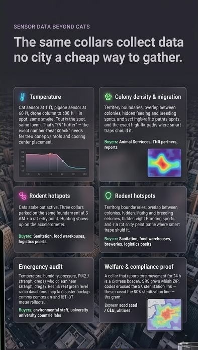
A $3 temperature/humidity sensor on a cat at 1 ft, on a pigeon at 30–150 ft, and on the drone hovering a column from 0 to 400 ft — same block, same minute. Delivered as "street level is X° hotter than roof level here", block by block, day and night. This is the missing input for heat-island work: where tree canopy, cool roofs, shade structures and cooling centers actually change what a person feels.
Temperature, humidity, pressure, and with a $10 add-on PM2.5 / VOC — from back alleys, loading docks and industrial lots where the official weather stations aren't.
Where sterilized working cats park at 3 AM is where the rats are. Dwell-time heatmaps plus accelerometer "hunting bursts" point the thermal drone and the traps.
Every node logs which nodes it can hear and how well (SNR/RSSI). Cats and pigeons wandering the city produce a ground-level LoRa coverage map — dead zones, good relay rooftops — for disaster backup comms and IoT meter rollouts.
Territory boundaries, overlaps, hidden feeding spots, the corridors between colonies. The map that tells a TNR partner where to trap next and proves the population is shrinking.
Zero movement for 24 h = distress beacon. Feed-station and litter-station logs per cat = health trend. GPS-backed sterilization % per ZIP = the trigger for performance-based grant payouts.
Once the gateways are on roofs and the collars are roaming, the network is a city asset. These are the uses that come up in the first conversation with any department.
Most California cities sit on or near a fault line. Meshtastic nodes keep passing text messages when cell towers and power are down — they run on batteries and talk to each other. The gateways we install for cats are a ready-made backup mesh for Emergency Management, with a coverage map already drawn by the cats.
Any resident can put the same $40 collar on their own cat or dog and opt into the mesh. A lost pet pings the nearest gateway — or a neighbour's cat — instead of vanishing. Animal Services gets a "last seen" map for every enrolled pet.
Colony cats cluster where food waste is dumped. Dwell-time heatmaps flag new dump sites in creek corridors and industrial back lots days before a complaint comes in.
Ground-level temperature and humidity — the exact inputs abatement districts use to predict breeding — from the shaded, damp corners no weather station covers.
Street-level heat readings next to playgrounds and sports fields, day by day, for the "is it too hot for recess" call and for where shade gets built next.
Neighbouring cities share shelters, colonies, rats and fault lines. Every California city has the same problem and the same rooftops. The playbook, the hardware list and the dashboard transfer as-is.
Anything published — heatmaps, coverage maps — is aggregated to block level. No addresses, no cat-by-cat tracks in residential areas.
Individual GPS tracks live in the dashboard under the TNR partner's and the city's accounts. Not sold, not shared with third parties.
The drone carries a radio and, for rodent sweeps, a thermal camera pointed at the contracted site. Feed-station cameras look at a feed station.
Meshtastic is open source on unlicensed 915 MHz. The city can audit exactly what the nodes send.