AntlerFlok
TrailTag · deep dive

The beacon people actually clip on is the one that's free at the trailhead.

Every year the national parks run thousands of searches for people who set out on a day hike. Almost none of them were carrying a locator. Not because they're reckless — because a real beacon costs a car payment and a subscription, and "it's only a day hike." TrailTag fixes the reason, not the hiker: a free tag in a pouch at the trailhead, tree-pinned mesh nodes along the route, and a ranger flock overhead that carries the last-heard point home.

Part of AntlerFlok. Same tag family as the harness; sources at the bottom.
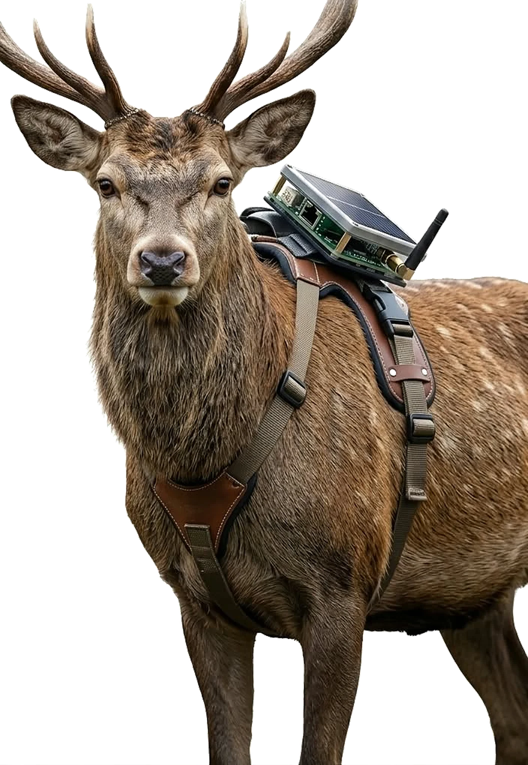
A stag wearing the AntlerFlok harness — the same radio family as the trailhead tag
Study 0 · the road

Deer–vehicle collisions are the biggest wildlife cost the country carries, and nobody knows where the herd crosses.

~1.8M
animal-collision insurance claims a year (US)State Farm claims data, July 2022–June 2023; deer are the large majority
~200
people killed a year in deer collisionsIIHS / HLDI; October–December is the peak, dusk the peak hour
$1B+
in vehicle damage a yearIIHS; average claim around $4–5k per collision
1 hop
from a harness on the herd to a roadside beacona collared herd within 300 ft of the highway lights the sign before the car gets there

Every state pays for this and none of them can see it coming. A season of harness tracks shows the exact 200 m of highway a herd crosses at 5 AM — where the wildlife crossing, the fence gap or the flashing sign actually goes. That is the first thing AntlerFlok gives a park or a DOT, before a single hiker is tagged.

Study 1 · the cost of losing people

What a decade of searching costs, and what it costs to never lose anyone.

Never again a loss for the lost.

65,439
search-and-rescue incidents in the national parks, 1992–2007NPS data (Heggie & Amundson): 78,488 people, 2,659 deaths, 13,212 lives saved
$58.6M
direct NPS search-and-rescue cost over those 16 years≈ $3.7M a year in NPS dollars alone — before the helicopters, the sheriffs and the volunteers
$1,500–5,000
per flight hour for a rescue helicoptermilitary and contract rates (est.); a multi-day search runs six figures fast
12–15
deaths a year in Yosemite alonewith ~200 SAR responses a year; 41 % of lost hikers simply wandered off the trail

Put it together and a big park's searches run into the tens of millions of dollars a decade once you count the helicopter hours, the county sheriff teams, the National Guard, the volunteers' days and the rangers pulled off everything else — on top of the deaths. Every one of those searches starts the same way: nobody knows where the person is.

The fix costs less than one search

  • A cheap tag at the gate. A $10–15 LoRa beacon handed out at the Yosemite entrance or the trailhead like a wristband or an anklet — snap it on, forget it. Boxes at the trailheads hold extras for the whole family. Drop it back in the box at the end, or keep it. Solar on the band: leave it in the sun and it charges itself; the gate hands them out charged either way. Two pings, you get both: a rapid ping every couple of minutes when you're moving or you press the button, a slow ping every fifteen when you're still — so the battery lasts the whole trip and then some, and the map still always knows.
  • You take it and you're good. The tag pings every few minutes. Tree nodes along the corridors, the herd's harnesses and the ranger flock all hear it. There is always a last-heard point on the map. You never get lost — you just get late. Unless you lose the tag. And the spare. And the other spare. Then — sorry, man, we tried. (Even then: we still have your track right up to where you dropped it, and that is where the search starts — hours of headway, not days. Literally a life saver.)
  • One button: find me. Hold the button on the band for three seconds and it goes to distress: full-power transmit, a ping every few seconds, a priority flag on every node that hears it, and an alert on the ranger screen and your family's tags at once. You don't need a signal bar. You need a thumb. With the pocket node it's a text too: "Oh shit — got hurt. Bear got my arm. I'm here, GPS sent, staying put." The station has the pin before you finish typing, your family sees it, and the drone is already lifting.
  • We know where you are — and you can text. The same tag family carries short messages over the mesh, no cell signal needed. "Running late, at the lake, all good" reaches the ranger station and your family's tags: fam to fam, tent to trailhead, hiker to ranger. The pocket node on a lanyard does it with any phone and the free app; the wristband beacon does location only. Hikers warn hikers too: "Bear at the creek crossing, big one, heading north" goes out from your tag and lands on every tag on that trail — with the distance: "bear reported 0.6 mi ahead, 12 minutes ago." Text in the wilderness, where no phone has ever had a bar. Same channel for the good stuff: "Buffalo herd in the meadow below the ridge, 40 head." "Elk at the lake, north shore, right now." Sightings pin to the map with a time, so the family two miles back knows where to go to see them — and the park gets a live wildlife map drawn by its own visitors. And it runs the other way — ranger to people: updates pushed to every tag on a trail. "Bear on the loop ahead, hold here." "Storm over the ridge in forty minutes, turn back." "Trail closed past the falls." "Park shutting down at six, head to the gate." "Concert at the meadow at eight." One message from the station reaches everyone out there at once, no bars, no app store. And the search itself becomes a conversation. The team has your coordinates on the map; they text you back: "We see you. Go down past the big tree, follow the stream, stay on the left bank — we're forty minutes out." You walk toward them instead of away — or, if you're hurt, "Stay put, keep warm, we have you," and the drone is overhead in twenty minutes. Most searches end before they start.
  • Drones find the ping. When someone is overdue, a drone with a LoRa receiver flies the corridor and hears the tag from the air — a whole valley in twenty minutes, at night, in weather a helicopter won't fly. Then a thermal camera confirms. No signal at all? The drone flies straight to the last location on the track and scours outward from there — the search radius is a few hundred yards, not a mountain range. One drone flight instead of a hundred boots and a helicopter.
  • Small enough to forget. Today's tag is the size of a matchbox on a band. The next one is AirTag-sized: a wristband, an anklet, a necklace, a bag tag, a belt hook, a zipper pull, a dog collar — same radio, same mesh, same map. Wear two or three in different spots — wrist, ankle, pack — so a lost one, a swim or a fall never leaves you dark. Hand a family five at the gate and nobody notices they're wearing them until the day it matters.
  • Whole park, for years, cheap. A few thousand tags, a few hundred tree nodes, a ranger drone: less than the price of a single multi-day helicopter search, and it keeps running.
One park, ten years (est.)
Searches today · direct NPS + helicopters + county + volunteers$15–40M
Deaths today100–150
AntlerFlok TrailTag · tags, tree nodes, drones, the ranger contract$1.5–3M
Searches that start with a last-heard pointnearly all
Estimates from the NPS incident data and typical helicopter and staffing rates; every park's number is different and we build it with the park before any agreement.
What search and rescue actually looks like

Yosemite is the case study. The pattern is every park.

The numbers below are from the park's own reporting and peer-reviewed reviews of NPS incident data. They move year to year; the shape doesn't.

≈ 200search-and-rescue responses a year in Yosemite191 in 2024, 214 in 2021; ~250/yr in the older ten-year review
12–15deaths a year in Yosemite on average16 in 2024, six of them natural causes; 14 in 2015
41 %of lost hikers simply wandered off the trailthe #1 cause, ahead of weather and falls
65,439NPS search-and-rescue incidents, 1992–200778,488 people · 2,659 deaths · 13,212 lives saved
84 %of all federal-land SAR 2019–2023 was in national parksGrand Canyon, Lake Mead and Yosemite lead the list
$ millionsa year in search costs across the parkshelicopter hours, teams, overtime — most of it spent narrowing a circle

Most rescues are slips and falls on hikes, dehydration and exhaustion, getting lost or stranded, water, and climbing. The common thread: they start as "overdue," and the first hours are spent figuring out where to look.
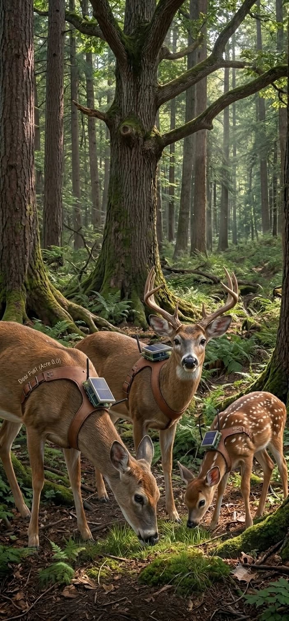
Concept art of a PidgeyFLok registration line
Why nobody's carrying one

A real beacon is $300–450 plus a subscription. A day hike is "just a day hike."

Personal locator beacons cost a few hundred dollars up front. Satellite messengers add a monthly plan, and hikers say the fee is what stops them — paying every month for a thing they hope never to press. Day hikers, who make up most of the rescues, don't own one at all. So the safety device with the best odds of being on a lost person is the one that's free, handed to you at the trailhead, and designed to clip on without thinking.

Make it freeA $12 LoRa beacon in a pouch. Grab one per person at the trailhead, drop it in the box at the end.
Or make it "mando"Where the park already issues permits — Half Dome, wilderness overnights — the tag rides with the permit. No tag, no permit.
The tag · why a person would actually attach it

Two pouches, one tag. Nothing to charge, nothing to pair, nothing to learn.

The mistake every beacon makes is asking the hiker to do something. TrailTag asks for one motion: clip it. It beacons on its own from the moment it leaves the trailhead box.

Pouch A · pack strapCarabiner pouch, high-vis, clips to a shoulder strap or belt loop in one hand. The default for adults.
Pouch B · wrist / lanyardElastic band or lanyard for kids and anyone without a pack. Two per family — the person most likely to separate wears one.
InsideXIAO nRF52840 + LoRa (Meshtastic), GNSS, 400 mAh cell: 3–5 days beaconing every few minutes. Under 30 g. Sealed. Bright colour.
ReturnDrop box at the trailhead. Tags charge on a rack overnight. A tag that doesn't come back by dark is the overdue list.
LayerWhat it doesCost est.
TrailTagThe hiker's beacon. Position every few minutes, no phone, no app.$12–18 each
Tree-pinned nodesSolar Meshtastic relays strapped to trees every 1–2 km along the trail and on the ridges. No trenching, no poles, no permits for towers — pin it to a tree.$60–90 each
The herdCollared deer and elk walk the same corridors every dusk; every harness relays every tag it hears back to the tree line.$25–40 per bird tag
Trailhead boxTag rack + charger + gateway + the drop box. Solar. One per trailhead.$1,500–3,000
DashboardOverdue list, last-heard map, one screen for dispatch and SAR.in-kind

Meshtastic is open-source firmware on unlicensed 915 MHz — no carrier, no plan, no license. Tags are trackers only; the tree nodes and the flock do the carrying.

Placement · by drone

Pin the whole park by drone. Ping it for years, for less than one search.

A tree node is a solar Meshtastic relay in a sealed box with a hook. A drone hangs it on a branch on the ridge or above the trail in a two-minute flight — no trench, no pole, no tower permit, no crew on the cliff. Fifty nodes cover a district in a day.

$60–90per tree node, solar, years of serviceThe cell is a buffer; the sun does the work. A 100-node park is under $10k of hardware.
1 searchcosts more than the whole park's nodesHelicopter hours and a multi-day team run into the tens of thousands. The kit pays for itself the first time it shortens one.
AntlerFlok harness
Managed service · the state contract

We place it, watch it, swap it. The park just gets the map.

Place

Drone-hung nodes, boxed trailheads, the herd

We survey the corridors people get lost in, fly the nodes in, set the trailhead boxes and hand the harnesses to the park biologists.

Monitor

Every node reports its own health

Battery, solar yield, uptime, last-heard neighbours. A node going quiet is a ticket before it's a gap.

Swap

Batteries, storm damage, a bird's harness

Scheduled rounds by the same caretakers who run the loft; drone re-hang when a tree comes down. Winter solar shortfall means a cell swap, not a dead corridor.

Pay

State / park contract

Priced per trailhead-year: hardware, placement, monitoring, swaps, tags, the dashboard. The park budgets a line item instead of a helicopter.

PidgeyFLok concept art
The data the same nodes give back

Every node is a weather station. The park gets its microclimates for free.

A $3 sensor on each tree node logs temperature, humidity and pressure every few minutes at that exact spot and elevation. Hang nodes from the valley floor to the ridge and the park has a live altitude-vs-temperature profile it has never had: where the inversion sits tonight, how much colder the canyon is than the rim, which drainage holds snow, which slope hits fire weather first.

Microclimates, mappedCold-air pools, sun slopes, wind gaps — the real conditions on the trail, not the airport's.
Altitude variablesLapse rate per corridor, measured, not assumed. Trail advisories that say "12° colder at the pass by 4 PM."
Fire weather + snowRelative humidity and temperature at ridge nodes feed red-flag calls; pressure and temp trends show storms arriving.
Play with itA public dashboard hikers can open at the trailhead box: conditions up the route, right now, from the nodes above them.
A rescue, walked through

Mist Trail, 2 PM. Off-trail at 3. Overdue at dusk.

Trailhead · 9 AM

Clip

Family of four takes four tags from the box. Kid's on a wristband. The box logs four tags out, party name, planned return "by dark."

Trail · all day

Heard

Tree nodes along the route hear each tag every few minutes and pass the points to the trailhead gateway. The flock's afternoon sweep logs them again from above.

3:10 PM

Off trail

One tag leaves the corridor above the falls — the #1 way people get lost. The nodes lose it after 400 m; the flock heard it at 3:40 near a drainage.

Dusk

Overdue → a circle

Three tags return, one doesn't. Dispatch opens the last-heard map: a 300 m circle at 3:40 PM, not a 30 km² drainage. The bird sweep or the drone goes first; the team goes to a point.

Prevention, not just rescueA tag that stops moving for an hour on a hot trail is a welfare check before it's a search. Rangers can text the trailhead box's overdue list at closing.
Bears, deer, lionsThe same nodes carry DeerFlok collars: a bear working the campground loop is an alert on the same screen — with the park biologists and their permits.
Honest limitsDeer walk where deer walk; tree nodes cover only the corridors they're pinned along. A search-starter and a deterrent, not a rescue guarantee.
Nationwide

Every park has trailheads, trees and a herd. That's the whole kit.

National parks reported the large majority of search-and-rescue incidents on federal land from 2019 to 2023. The kit doesn't change from park to park: a trailhead box, tree-pinned nodes along the corridors people get lost in, a ranger loft where the flock lives, and a dashboard for dispatch. Start with the three parks that run the most searches — Grand Canyon, Lake Mead, Yosemite — and copy.
Per trailhead1 box · 6–12 tree nodes · 60–100 tags · ≈ $4,000–8,000 est.
Per park1–3 lofts · 100–250 birds · one dashboard · caretaker rounds folded into ranger duty
PidgeyFLok
DeerFlok gallery

Field pictures

Photos and concept art from the flock. More land here as they come in.

Sources
  1. Heggie TW, Amundson ME. Dead men walking: search and rescue in US National Parks. Wilderness & Environmental Medicine, 2009 — 65,439 SAR incidents, 78,488 people, 2,659 deaths, $58.6M direct cost, 1992–2007.
  2. State Farm, "Animal collision" claims analysis 2023 (1.8 M US animal-collision claims, July 2022–June 2023).
  3. Insurance Institute for Highway Safety / HLDI, deer–vehicle collision fatality and claim data (about 200 deaths a year; over $1 billion in damage).
  4. Yosemite Search and Rescue 2024 rescue, death numbers released — SFGATE
  5. Search and Rescue in Yosemite National Park: A 10-Year Review — Wilderness & Environmental Medicine
  6. Dead Men Walking: Search and Rescue in US National Parks — Wilderness & Environmental Medicine (1992–2007 NPS data)
  7. Search and Rescue (SAR) Operations on Federal Lands — Congressional Research Service
  8. How 100 Hikers Got Lost and How They Survived — Gripped (41 % wandered off trail)
  9. Multiple Search-and-Rescue Missions Due to Hikers Leaving Trails — NPS Yosemite
  10. Do you need an emergency beacon for hiking? — Advnture (cost and subscription barriers)
  11. National park searches, rescues costing millions — Fox News